I have been following San Francisco's own "digital cartographer" Eric Fischer for awhile now, so I'm a bit surprised that I
just found this set on his Flickr photostream. In 2010 Fischer presented a series of maps that documented the intensity of geo-tagged photography in over a hundred metro regions around the world. In his updated set he breaks this information down a bit further, into 'tourists' and 'locals' - users/photographers that uploaded multiple photos of the area more than a months apart.
The project was initially an effort to see if the earlier
Geotaggers' World Atlas maps were primarily sourced by tourist photography, but the product became a veritable GIS map comparing trending tourist activity to areas where local residents spend their time.
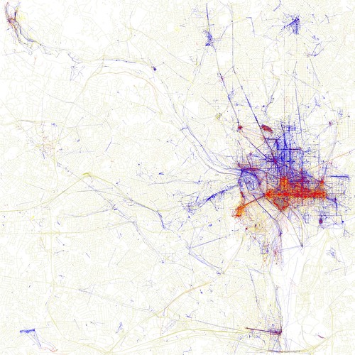 |
| Washington, District of Columbia |
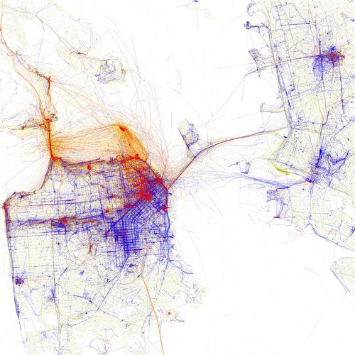 |
| San Francisco, Oakland and Berkeley |
Check out your own local metro region in the set on Fischer's photostream.

No comments:
Post a Comment